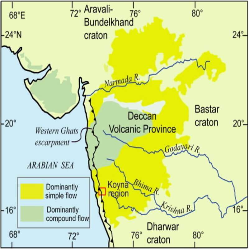
India’s Deep Drilling mission in the Koyna-Warna region of Maharashtra is an ambitious scientific endeavour to understand the complex geological processes underlying this seismically active area. Here are the key aspects and significance of this mission.
The Koyna-Warna region in Maharashtra is significant for its geological and seismological characteristics. It is located in the Western Ghats and is primarily known for the Koyna Dam and its associated seismic activity.
The region provides valuable insights into reservoir-induced seismicity, making it a focal point for geological and seismological research.
India’s Deep Drilling Mission
- Understanding Earthquakes: The primary objective of the deep drilling mission is to gain insights into the mechanics of earthquakes.
- The Koyna-Warna region is a unique natural laboratory where reservoir-induced seismicity (earthquakes triggered by the filling and operation of large reservoirs) can be studied in detail.
- Understanding these processes can help in predicting and mitigating the impacts of earthquakes.
- Seismic Monitoring: Scientists can install instruments at various depths to monitor seismic activity directly within the earthquake-generating zone by drilling deep into the Earth’s crust.
- This provides a more precise understanding of seismic activities compared to surface monitoring.
- Geological and Geophysical Studies: The mission also aims to study the geological and geophysical properties of the Earth’s crust in this region. This includes analyzing rock formations, fault lines, and the stresses and strains within the Earth’s crust.
- Advancing Technology: The deep drilling project involves the use of advanced drilling technology and scientific equipment, contributing to technological advancements in geoscience research.
Deep Drilling in the Koyna-Warna region

The Borehole Geophysics Research Laboratory (BGRL) in Karad, Maharashtra, is a specialised institute under the Ministry of Earth Sciences of the Government of India mandated to execute India’s sole scientific deep-drilling programme.
Under BGRL, the aim is to drill the earth’s crust to a depth of 6 km and conduct scientific observations and analysis to help expand the understanding of reservoir-triggered earthquakes in the active fault zone in the Koyna-Warna region of Maharashtra.
Phases: The mission is being executed in multiple phases, starting with pilot boreholes to gather preliminary data, followed by deeper drilling operations.
- At present, the Koyna pilot borehole is about 0.45 m wide (at the surface) and roughly 3 km deep.
- The drilling technique: a hybrid of two well-established techniques called mud rotary drilling and percussion drilling (a.k.a. air hammering).
- In the next phase, when the borehole depth increases beyond 3 km and strikes for 6 km, the entire rig will have to be updated with exponentially enhanced capacity.
What is scientific deep drilling?
Scientific deep-drilling is the process of drilling deep into the Earth’s crust to obtain data and samples from subsurface layers that are not otherwise accessible.
This technique is used in various fields of science, including geology, oceanography, and environmental science, to study the composition, structure, and history of the Earth.
Key Aspects of Scientific Deep-Drilling:
- Depth: Deep-drilling projects typically reach depths ranging from several kilometres to over 10 kilometres below the Earth’s surface. The deepest scientific drilling projects have aimed to penetrate the Earth’s crust and upper mantle.
- Technology: Advanced drilling technologies and equipment are used, including rotary drilling rigs, diamond-tipped drill bits, and sophisticated downhole measurement tools. Innovations in drilling technology enable precise control and monitoring of the drilling process.
- Sampling: Core samples are extracted from the drilling site. These cylindrical sections of rock and sediment provide valuable information about the subsurface conditions, including mineral composition, temperature, pressure, and the presence of fluids.
- Data Collection: In addition to physical samples, a range of data is collected during drilling. This includes geophysical measurements such as seismic, magnetic, and electrical properties, as well as temperature and pressure profiles.
Purposes of Scientific Deep-Drilling
- Geological Research: Understanding the Earth’s structure, tectonic activity, and geological history. Deep-drilling helps in studying the composition and behavior of the Earth’s crust and mantle.
- Climate Studies: Analyzing ice cores and sediment layers to reconstruct past climate conditions. This information is crucial for understanding long-term climate change and predicting future trends.
- Resource Exploration: Investigating potential sources of minerals, oil, natural gas, and geothermal energy. Deep-drilling helps in assessing the availability and extraction feasibility of these resources.
- Seismology: Studying earthquake mechanisms and the properties of fault zones. Deep-drilling into seismic zones provides insights into the processes that cause earthquakes and helps in earthquake prediction and mitigation.
- Environmental Science: Monitoring subsurface pollution, groundwater contamination, and the impact of human activities on the subsurface environment. Deep-drilling projects can help assess and mitigate environmental hazards.
Outcomes and Benefits
- Seismic Risk Reduction: Improved understanding of the seismic risks in the Koyna-Warna region can lead to better risk mitigation strategies, protecting lives and infrastructure.
- Scientific Knowledge: The data and findings from this mission will contribute significantly to the global knowledge of earthquake mechanics and the behaviour of the Earth’s crust.
- Resource Management: Insights gained from this mission can also aid in the management of natural resources, such as groundwater and hydrocarbons, by understanding the subsurface geological structures.
- International Collaboration: The project has the potential to foster international collaborations, bringing together scientists from various countries to study the data and contribute to the research.
Challenges
Scientific deep drilling remains the most reliable method because it helps get direct (in situ) and near-source measurements. Researchers can also capture rock and sediment cores aligned with the earth’s timeline from within the borehole.
It is also the most challenging method: deep drilling is labour- and capital-intensive. The earth’s interior is also a hot, dark, high-pressure region that hinders long and continuous operations.
- Technical Difficulties: Drilling to such depths presents significant technical challenges, including high temperatures, pressures, and the need for precise instrumentation.
- Environmental Concerns: Ensuring that the drilling operations do not adversely affect the environment or trigger unintended seismic activities is a critical concern.
- Access: Making observations inside the earth is difficult due to challenges of access. Scientifically drilled boreholes to great depths can be thought of as downward-looking telescopes, which when instrumented with sensors serve as geological observatories.
- Human resources: The process needs highly skilled and trained technical personnel for a 24/7 on-site engagement for about six to eight months at a time in harsh weather conditions — and this was the case for the 3 km pilot borehole. For a 6 km borehole, 24/7 drilling will last for at least 12-14 months.
Conclusion
India’s Deep Drilling mission at the Koyna-Warna region represents a significant step forward in earthquake research and geoscience.
The findings from this mission are expected to enhance our understanding of seismic processes and contribute to better disaster preparedness and resource management.
Frequently Asked Questions (FAQs)
Q. What is the Koyna-Warna region?
Ans: The Koyna-Warna region in Maharashtra is significant for its geological and seismological characteristics. It is located in the Western Ghats and is primarily known for the Koyna Dam and its associated seismic activity. The Koyna-Warna region is a unique and significant area due to its combination of a large hydroelectric project and its status as a seismically active zone.
Q. Why is India deep drilling in Maharashtra’s Koyna?
Ans: To conduct scientific observations and analysis to help expand the understanding of reservoir-triggered earthquakes in the active fault zone in the Koyna-Warna region of Maharashtra.
Q. What caused the Koyna Dam earthquake?
Ans: The filling and emptying of the Koyna and Warna reservoirs are linked to increased seismic activity. Studies suggest that changes in the water levels of the reservoirs cause stress adjustments in the Earth’s crust, leading to earthquakes.
Related articles:
-Article by Swathi Satish


Leave a Reply