A study has revealed a crucial connection between Volcanic Eruptions and ionospheric Disturbances. It highlights how volcanic eruptions can trigger ionospheric disturbances and space weather that affect satellite communication and navigation systems. Read here to learn more.
A recent study has revealed a remarkable connection between the massive Tonga submarine volcano eruption on January 15, 2022, and the formation of Equatorial Plasma Bubbles (EPBs), an ionospheric disturbance.

The eruption in the South Pacific sent shock waves and atmospheric pressure pulses into the upper atmosphere, influencing space weather and triggering the formation of EPBs near the Earth’s geomagnetic equator, particularly over the Indian subcontinent.
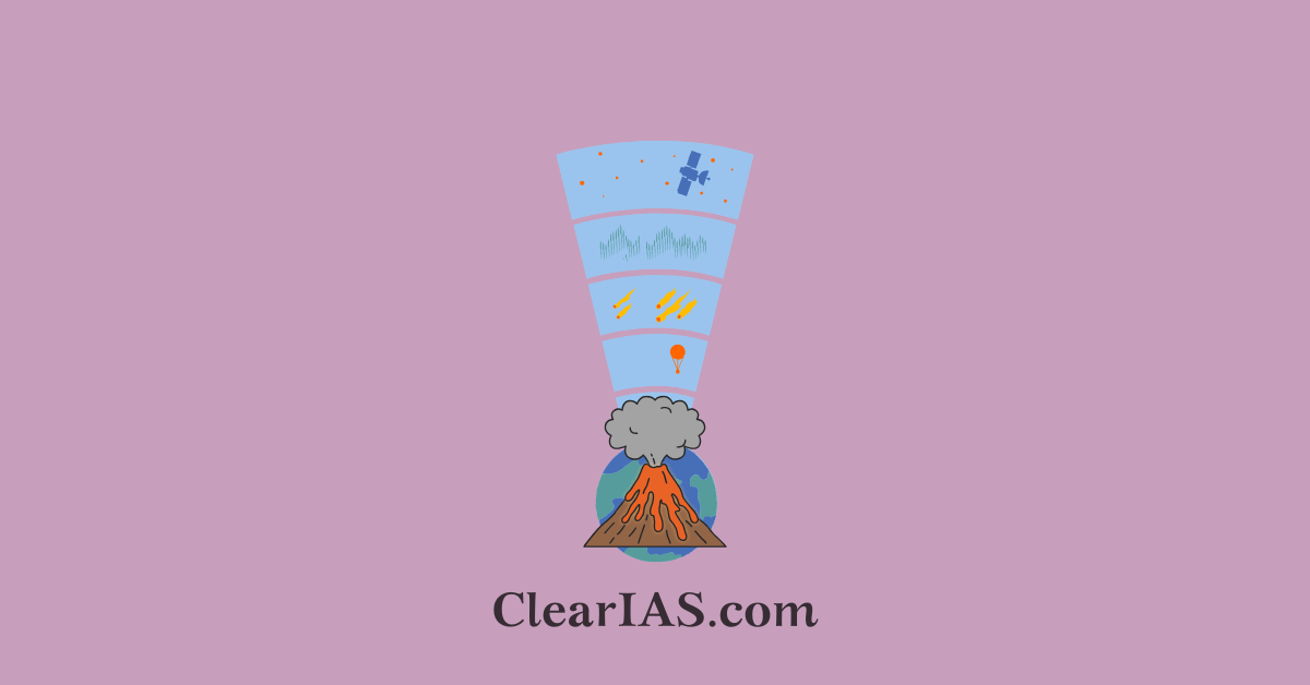
Volcanic Eruption & Ionospheric Disturbances
- Volcanic Eruption and Ionospheric Disturbances: The energy released by the Tonga eruption propagated into the ionosphere, the region of Earth’s atmosphere that contains ionized particles. This caused disturbances that led to the creation of Equatorial Plasma Bubbles, which are depletions of electron density occurring mainly at night over the equatorial and low-latitude regions.
- Space Weather Impact: The eruption-induced EPB can disrupt satellite communication and navigation systems by scattering radio waves. These disturbances are especially significant in the Indian subcontinent, where EPBs have been observed.
- Implications for Satellite Systems: The findings highlight how volcanic eruptions can extend their influence beyond the atmosphere and into space weather, potentially affecting systems that rely on satellite signals, such as GPS and communications technologies.
Key highlights of the study
On January 15, 2022, the Tonga volcano located 65 km (40 mi) north of Tongatapu, Tonga’s main island in Polynesia, erupted with extraordinary force sending shock waves through the atmosphere.
Scientists were intrigued by the subsequent formation of EPBs in the evening hours over the Indian region.
Scientists at the Indian Institute of Geomagnetism (IIG) Navi Mumbai, an autonomous institute of the Department of Science and Technology, explored the connection between the Tonga volcanic eruption and the EPBs.
- They found that the eruption produced strong atmospheric gravity waves that propagated into the upper atmosphere, triggering ionospheric conditions favourable to triggering EPBs.
- They used ionosonde observations from Tirunelveli and Prayagraj to detect spread-F traces- a phenomenon in the ionosphere where electron density becomes irregular causing spread in radio signals and leading to fading or disruptions in communications.
The scientists analyzed various atmospheric and ionospheric data to understand how disturbances triggered by the eruption led to the generation of EPBs.
- Observations from NASA’s Ionospheric Connection Explorer (ICON) (wind, ion density, and temperature) and Swarm satellites provided a comprehensive view of the ionospheric changes during the event, confirming that the eruption-induced gravity waves played a crucial role in initiating these plasma instabilities.
- Plasma blobs, as well as enhanced Pre-Reversal Enhancement (PRE)- a sharp increase in the ionospheric eastward electric field in the dusk sector before it turns westward in the late-night hours, triggered by atmospheric disturbances were also detected.
- Further analysis of iso-frequency and Total Electron Content (TEC) data from Global Navigation Satellite System (GNSS) measurements across the Indian region revealed gravity wave-like oscillations/Traveling Ionospheric Disturbances (TIDs) moving across Indian longitudes in the equatorial ionosphere.
- This indicated that the volcanic eruption had a widespread impact on the ionosphere and acted as a seeding mechanism for EPB generation.
- This comprehensive utilization of data from multiple sources gave the researchers a multi-dimensional view of the ionospheric disturbances.
Atmospheric gravity waves
Atmospheric gravity waves are oscillations in the Earth’s atmosphere that occur when buoyancy forces attempt to restore equilibrium after air is displaced vertically, particularly in stable layers.
These waves are similar to waves on water, but they occur within the atmosphere.
They play an important role in transferring energy and momentum through the atmosphere, influencing weather patterns and the dynamics of the upper atmosphere.
- Formation:
- Atmospheric gravity waves are often generated when airflow is disturbed by physical barriers such as mountains (known as mountain waves) or by convection, jet streams, or weather fronts.
- When air is pushed upwards by a disturbance, buoyancy forces try to bring the air back to its original position. This results in an oscillating wave motion as the air overshoots, generating a wave-like pattern.
- Propagation:
- These waves can travel both horizontally and vertically. As they propagate upwards, the amplitude of the waves tends to increase because the air density decreases with altitude. This can lead to wave breaking at higher altitudes, releasing energy and momentum into the upper atmosphere.
- Impact on Weather and Climate:
- Local Weather: Gravity waves can impact local weather systems by influencing cloud formation, turbulence, and precipitation. For example, they can create lenticular clouds, which appear as lens-shaped clouds over mountains.
- Global Circulation: On a larger scale, gravity waves contribute to the transfer of energy and momentum between different atmospheric layers. This process helps shape global circulation patterns, including the jet streams and stratospheric circulation.
- Wave Breaking:
- Similar to ocean waves crashing on the shore, atmospheric gravity waves can “break” when their amplitude becomes too large. This occurs typically in the upper atmosphere, contributing to turbulence and the mixing of atmospheric layers.
Applications and Observations:
- Weather Forecasting: Understanding gravity waves is crucial for improving weather models, especially for predicting phenomena like turbulence and the development of severe storms.
- Aviation: Gravity waves can create turbulence in the atmosphere, which poses challenges for aviation safety, particularly near mountain ranges.
Ionospheric disturbances
Ionospheric disturbances refer to disruptions in the ionosphere, the layer of Earth’s atmosphere that contains a high concentration of ions and free electrons, extending from about 60 km to 1,000 km above the Earth’s surface.
The ionosphere plays a critical role in radio wave propagation, and disturbances can impact communication systems, GPS signals, and satellite operations.
Causes of Ionospheric Disturbances:
- Solar Activity: The primary cause of ionospheric disturbances is solar activity, including:
- Solar Flares: Sudden bursts of energy from the Sun that increase ionization in the ionosphere, particularly in the D-layer, causing shortwave radio signal blackouts.
- Coronal Mass Ejections (CMEs): Massive bursts of solar wind and magnetic fields that disrupt the Earth’s magnetic field and ionosphere, triggering geomagnetic storms.
- Solar Wind: Variations in the solar wind can lead to fluctuations in the ionosphere.
- Geomagnetic Storms: These are disturbances in the Earth’s magnetosphere caused by the interaction of the solar wind with Earth’s magnetic field. The resultant geomagnetic activity leads to ionospheric irregularities.
- Auroras: Charged particles from the Sun entering Earth’s atmosphere during geomagnetic storms create visual phenomena like the northern and southern lights, while simultaneously causing ionospheric disturbances.
- Sudden Stratospheric Warmings (SSWs): Rapid temperature increases in the stratosphere can also influence the ionosphere by altering atmospheric circulation and dynamics.
Types of Ionospheric Disturbances:
- Sporadic E-Layer: This phenomenon involves the formation of highly concentrated patches of ionization in the E-layer of the ionosphere, affecting radio communications by causing unexpected reflection of radio waves.
- Sudden Ionospheric Disturbances (SIDs): These occur when solar X-rays increase ionization in the D-layer, leading to the absorption of high-frequency (HF) radio waves and causing shortwave radio blackouts.
- Ionospheric Scintillation: This is rapid fluctuation in the strength of satellite signals caused by irregularities in the ionosphere, often due to geomagnetic storms. It can severely impact GPS accuracy.
- Ionospheric Storms: Prolonged disturbances triggered by solar wind or CMEs, which cause unpredictable changes in the ionosphere’s density and height, affecting both high-frequency radio signals and satellite communication.
Effects:
- Communication Disruptions: HF radio signals, which rely on ionospheric reflection, can experience blackouts or poor propagation during disturbances.
- GPS and Satellite Navigation: Signal degradation due to ionospheric scintillation can reduce the accuracy and reliability of GPS systems.
- Power Grids: Severe geomagnetic storms can induce currents in power grids, potentially causing outages and damage.
Significance of the study
The study offers new insights into how natural disasters like volcanic eruptions can significantly influence space weather, affecting satellite communication and navigation systems.
- The Tonga Volcano identified as a cause for these ionospheric disturbances is a real-world example showing the need for monitoring space weather conditions in the aftermath of major geological events, adding to existing knowledge of ionospheric dynamics.
- The connection established between geological events and ionospheric dynamics is important for satellite communication and relevant for sectors like defence, agriculture, aviation, disaster management, and any other areas that rely on Global Positioning Systems (GPS) and satellite-based technologies.
- The study can help improve forecasting of ionospheric disturbances leading to better early warning systems that involve satellite signal interference, benefiting fields like navigation, aviation, and military operations.
- This will allow governments and industries to better prepare for and mitigate disruptions in essential services like GPS, air traffic control, and satellite communications.
Tonga volcano

The Tonga Volcano, also known as the Hunga Tonga–Hunga Ha’apai volcano, is a large undersea volcano located in the South Pacific Ocean, approximately 65 kilometres north of Tonga’s main island, Tongatapu. It is part of the Pacific “Ring of Fire,” an area known for its volcanic activity.
In January 2022, the Hunga Tonga–Hunga Ha’apai volcano experienced one of the largest volcanic eruptions of the 21st century, with a series of powerful explosions culminating in a massive eruption on January 15. The eruption had significant global impacts:
- Shockwaves: The explosion sent shockwaves around the globe multiple times, and it was felt as far away as Alaska. The volcanic blast was equivalent to hundreds of nuclear bombs in terms of energy release.
- Tsunami: The eruption triggered a powerful tsunami that affected not only Tonga but also other Pacific nations, including New Zealand, Japan, the U.S. West Coast, and South America. It caused widespread damage in Tonga, with waves as high as 15 meters.
- Atmospheric Impact: The eruption sent a massive plume of ash, gas, and steam up to 58 kilometres into the stratosphere. This ash cloud disrupted satellite communications and air travel and had a noticeable cooling effect on the planet’s weather for some time.
- Global Climate Effects: The sheer amount of water vapour and sulfur dioxide ejected into the atmosphere has raised concerns about potential short-term climatic changes. The water vapour could contribute to a slight warming effect, while the sulfur dioxide may cause cooling by reflecting sunlight away from the Earth.
Volcanic Features:
- Submarine Nature: Hunga Tonga–Hunga Ha’apai is mostly underwater, with only small islands appearing above sea level before the eruption. After the 2022 event, much of the above-sea portion of the volcano was destroyed.
- Caldera Formation: The eruption is believed to have caused the collapse of a part of the caldera (a large volcanic crater), which intensified the explosion.
Aftermath:
Tonga faced significant challenges in the aftermath, including water contamination due to volcanic ash, infrastructure damage, and the loss of communication lines, as the eruption severed an undersea cable connecting Tonga to the global internet. The international community, including Australia, New Zealand, and Japan, provided aid to Tonga following the disaster.
The Tonga volcano eruption of 2022 is regarded as one of the most powerful in recent history, with widespread environmental and humanitarian impacts.
Conclusion
In today’s world, satellite-based communication and navigation systems are critical for numerous sectors.
Understanding how natural disasters, like volcanic eruptions, can impact the ionosphere is essential for predicting and mitigating disruptions in these systems.
While previous studies have established that EPBs can disrupt satellite signals, the role of terrestrial events in shaping space weather has not been explored.
This discovery underscores the interconnectedness of Earth’s atmosphere and space weather, revealing how natural disasters like volcanic eruptions can influence technological systems on a global scale.
Previous Year Question
Q. Consider the following statements: (2018)
- The Barren Island volcano is an active volcano located in the Indian territory.
- Barren Island lies about 140 km east of Great Nicobar.
- The last time the Barren Island volcano erupted was in 1991 and it has remained inactive since then.
Which of the statements given above is/are correct?
(a) 1 only
(b) 2 and 3
(c) 3 only
(d) 1 and 3
Related articles:
-Article by Swathi Satish

IAS/IPS/IFS Smart Preparation Strategy: FREE Mentorship – Register Now!
Aim IAS/IPS/IFS?


Leave a Reply